
Comparison of Drainage Network Extraction from Different DEM Data Sources: A Case Study of Hanjiang River Basin
Received date: 2011-10-13
Request revised date: 2011-12-15
Online published: 2012-09-20
Copyright
Based on the three DEMs of HYDRO1K, SRTM3 (version 4) and ASTER GDEM, drainage networks of Hanjiang River basin are extracted by using the terrain module of BTOPMC. The comparison shows that: ① the accuracy of drainage networks extracted from SRTM3 is the highest, then that from ASTER GDEM. The accuracy of drainage networks extracted from HYDRO1K are not so good. ② The vertical accuracy of DEM controls the accuracy of drainage network extraction. Although the horizontal resolution of ASTER GDEM is high, its vertical accuracy is not so good as SRTM3. Thus, the accuracy of drainage networks extracted from ASTER GDEM is not so good as that from SRTM3, both in whole basin and in sub-basins. ③ In large basin, drainage networks extracted from HYDRO1K are reasonable but become bad in low-relief regions. HYDRO1K is unsuitable for drainage network extraction in small-scale basins. ④ The accuracy of drainage network extraction from DEM is affected by local terrain slopes and the depression filling algorithm. Compared with Arc Hydro Tools, the terrain module of BTOPMC avoids most parallel channels. Also, the threshold contributing area used for channel sources should be identified by referring to the map scale.
Key words: DEM; horizontal resolution; digital drainage network; Hanjiang River basin
LIU Yuan , ZHOU Mai-chun , CHEN Zhi-jing , LI Shao-wen . Comparison of Drainage Network Extraction from Different DEM Data Sources: A Case Study of Hanjiang River Basin[J]. SCIENTIA GEOGRAPHICA SINICA, 2012 , 32(9) : 1112 -1118 . DOI: 10.13249/j.cnki.sgs.2012.09.1112
Fig.1 Drainage networks of Hanjiang River basin(from the Hanjiang River Administration Bureau)图1 韩江流域水系(韩江流域管理局官方图) |
Fig.2 Elevation frequency curve of the study region图2 研究区域的高程累积分布 |
Table 1 The features of DEMs in the study region表1 研究区域DEM的基本特征 |
| 数据源 | HYDRO1K | SRTM3 | ASTER GDEM |
|---|---|---|---|
| 水平分辨率(m) | 1000 | 90 | 30 |
| 栅格数(列×行) | 195×340 | 2199×3826 | 6533×11367 |
| 最大高程(m) | 1675 | 1792 | 1808 |
| 最小高程(m) | 0 | -15 | -33 |
| 平均高程(m) | 397.3 | 396.9 | 389.4 |
| 高程标准差(m) | 255.9 | 262.8 | 263.9 |
Fig.3 Digital drainage network of Hanjiang River basin extracted from DEMs图3 DEM提取的韩江流域数字河网 |
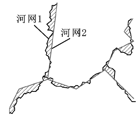
Fig.4 Overlay of digital drainage network图4 数字河网的套合对比 |
Table 2 Comparison of the features of digital drainage network in Hanjiang River basin by HYDRO1K,SRTM3 and ASTER GDEM表2 韩江流域数字河网特征对比 |
| 数据源 | HYDRO1K | SRTM3 | ASTER GDEM | |
|---|---|---|---|---|
| 计算 效率 | 洼地栅格百分比(%) | 16.0 | 7.9 | 11.3 |
| 填洼循环次数 | 198 | 8412 | 21570 | |
| 填洼耗时 | 少 | 中等 | 多 | |
| 流域 面积 | 数字流域面积(km2) | 29689 | 29243 | 29560 |
| 相对误差(%) | 2.10 | 0.57 | 1.66 | |
| 坡度 tanβ | 最大值 | 0.610 | 2.569 | 4.384 |
| 最小值 | 8.600×10⁻⁸ | 2.400×10⁻⁸ | 1.330×10⁻⁷ | |
| 平均值 | 0.072 | 0.242 | 0.238 | |
| 标准差 | 0.073 | 0.183 | 0.190 | |
Fig.5 Slope distribution curve of Hanjiang River basin图5 韩江流域的坡度累积分布 |
Fig.6 Digital drainage network of Tingjiang River basin extracted from DEMs图6 DEM提取的汀江流域数字河网 |
Fig.7 Digital drainage network of Meitanhe River basin extracted from DEMs图7 DEM提取的梅潭河流域数字河网 |
Table 3 Comparison of the features of digital drainagenetwork in Tingjiang River and Meitanhe River basins表3 汀江、梅潭河流域数字河网特征对比 |
| 数据源 | HYDRO1K | SRTM3 | ASTER GDEM | |
|---|---|---|---|---|
| 汀江 流域 | 流域面积(km2) | 3697 | 3542 | 3786 |
| 平均坡度 tanβ | 0.065 | 0.244 | 0.245 | |
| 与标准河网吻合度(套合差) | 差 | 好 (4.40%) | 一般 (5.69%) | |
| 梅潭河 流域 | 流域面积(km2) | 1574 | 1624 | 1591 |
| 平均坡度tanβ | 0.107 | 0.304 | 0.296 | |
| 与标准河网吻合度(套合差) | 较差 | 很好 (3.62%) | 好 (4.45%) | |
The authors have declared that no competing interests exist.
| [1] |
|
| [2] |
|
| [3] |
|
| [4] |
|
| [5] |
|
| [6] |
|
| [7] |
|
| [8] |
|
| [9] |
|
| [10] |
|
| [11] |
|
| [12] |
|
| [13] |
U.S. Geological Survey. HYDRO1k Elevation Derivative Database[EB/OL].
|
| [14] |
Jarvis A, Reuter H I, Nelson A, et al. Hole-filled seamless SRTM data V4, International Centre for Tropical Agriculture (CIAT)[EB/OL]. 2008,
|
| [15] |
Earth Remote Sensing Data Analysis Center (ERSDAC). ASTER GDEM[EB/OL].
|
| [16] |
|
| [17] |
|
| [18] |
|
| [19] |
|
| [20] |
|
| [21] |
|
/
| 〈 |
|
〉 |


