×
模态框(Modal)标题
在这里添加一些文本
Close
Close
Submit
Cancel
Confirm
×
模态框(Modal)标题
×
Journal
Article
Figure
Search
EN
中文
Home
About Journal
About Journal
Indexed in
Awards
Editorial Board
Guide for Authors
Browse
Current Issue
Online First
Archive
Highlights
Topic
Archive by Subject
Most Viewed
Most Download
Most Cited
E-mail Alert
RSS
Subscribe
Contact us
EN
中文
Figure/Table detail
Extraction of spring farmland plastic mulching in Qianguo County based on Google Earth Engine
Deng Yunyao, Li Xiaojie, Ren Jianhua
SCIENTIA GEOGRAPHICA SINICA
, 2024, 44(
8
): 1417-1425. DOI:
10.13249/j.cnki.sgs.20230651
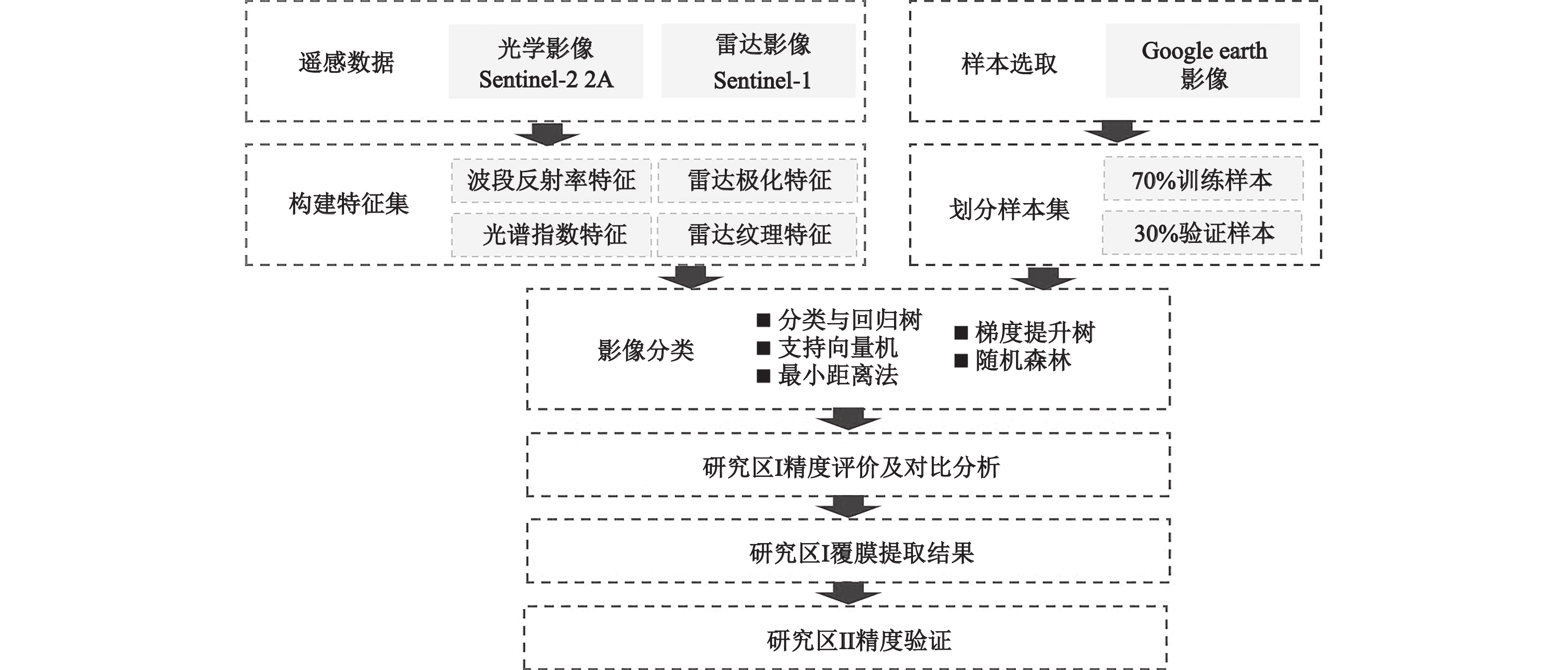
Fig. 3
Technique flow chart of farmland plastic muching extraction
Other figure/table from this article
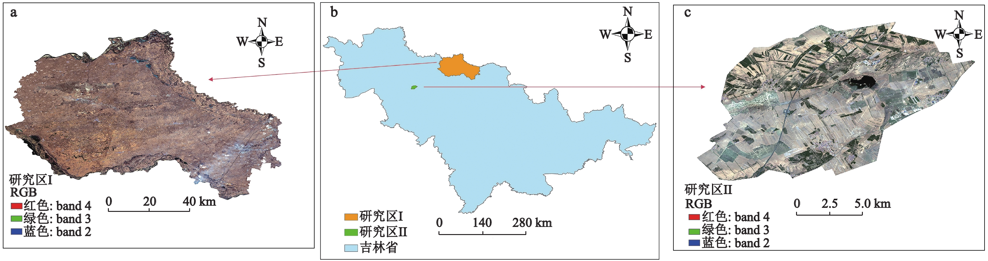
Fig. 1
Location and remote sensing images of study area
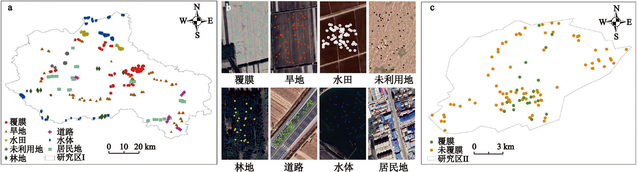
Fig. 2
Sample points in study area
Table 1
Feature sets of optical and radar images in the farmland plastic mulching extraction model
Table 2
Classification accuracy of different input features and machine learning methods
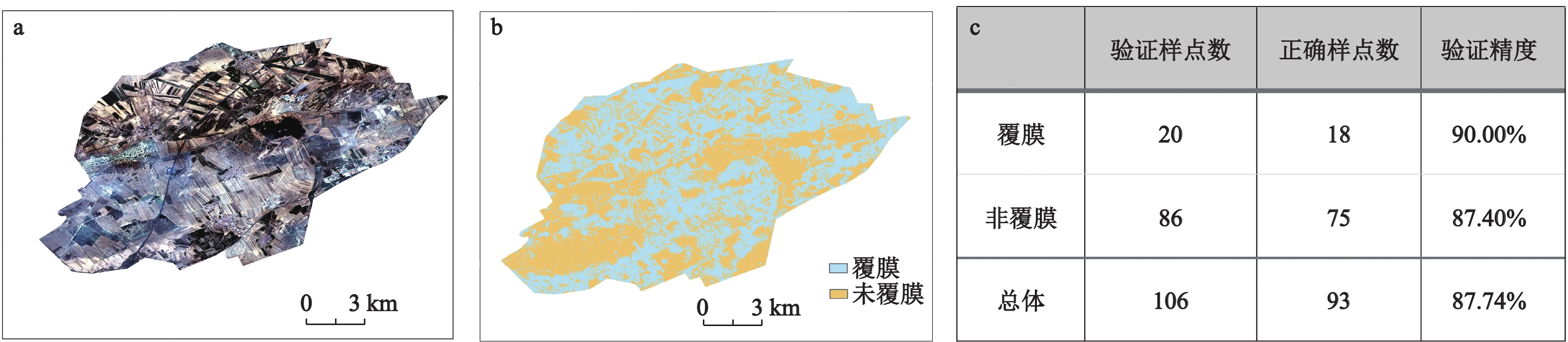
Fig. 4
Comparison between extraction results and remote sensing images in study area II
Appendix Table 1
The classification results of different schemes are compared with Sentinel-2 true color synthetic images